|
Fire Potential / Fire Danger Maps |
Current Conditions |
Forecast |
Image Archive |
Data Archive |
|---|---|---|---|---|
|
Fire Danger Rating |
|
A Fire Danger Rating level takes into account current and antecedent weather, fuel types, and both live and dead fuel moisture (Deeming and others 1977, Bradshaw and others 1984).
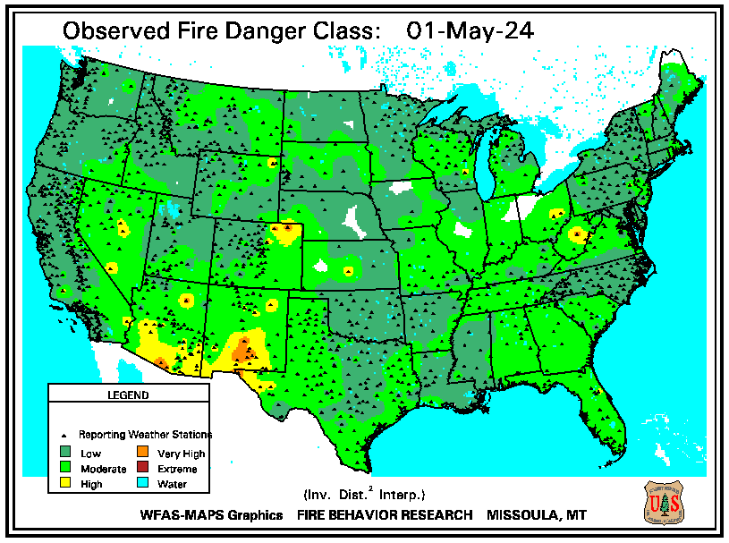
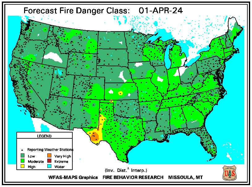 The adjective class rating is a method of normalizing rating classes across different fuel models, indexes, and station locations. It is based on the primary fuel model cataloged for the station, the fire danger index selected to reflect staffing levels, and climatological class breakpoints. This information is provided by local station managers. About 90% use the Burning Index (BI); others use Energy Release Component (ERC). Staffing class breakpoints are set by local managers from historical fire weather climatology.
Only reporting station locations are indicated with a marker on the maps. Values between stations are estimated with an inverse distance-squared technique on a 10-km grid. This works pretty well in areas of relatively high station density, but has obvious shortcomings in other areas.